11/22/2018 How I spent the Mississippi 2018-2019 Quail Season Opener
Hopefully everyone had a happy and gratitude filled Thanksgiving 2018. The fact that it also marked the start of the 2018-2019 Mississippi quail season was but one of many reasons I had to be thankful for.
My family celebrated Thanksgiving in Tippah County in Northeast Mississippi, and I elected to start my public land pursuit of the elusive game bird at nearby Tuscumbia WMA. Tuscumbia WMA is in Corinth, MS and consists of two distinct tracts “Unit 1 and Unit 2”. Unit 1 is primarily permanent wetland, void of interior roads, and difficult to access without a boat, save one walk-in location that quickly turns to tough going. Unit 2 is primarily abandoned agricultural fields converted into waterfowl impoundments. It has highly walkable interior roads and mowed shooting/walking lanes throughout.
I arrived around 8:45, and started my trek from the WMA headquarters. I first bushwhacked through the wooded areas and still yet to be filled waterfowl impoundments before growing tired and electing to stick roads, trails, and food plots. As in prior days (I had archery hunted Unit 2 twice before) I saw plenty of ducks, deer and deer signs, but not a single quail was pointed, flushed, or heard.
The screenshot below shows my Unit 2 route along with WMA boundaries I created using the iOS version of the Google Maps app.
My initial take on Tuscumbia is that it would make a fine place to bow hunt, especially Unit 2 and early season, and it would make an even finer place to waterfowl hunt if you are lucky enough to get drawn or brave enough to try and stand by.
I will likely not do a quail walk here again until the final dove split (as the State prepared a dove field on Unit 2), but if I am drawn for a duck hunt, I’ll be there if I can.
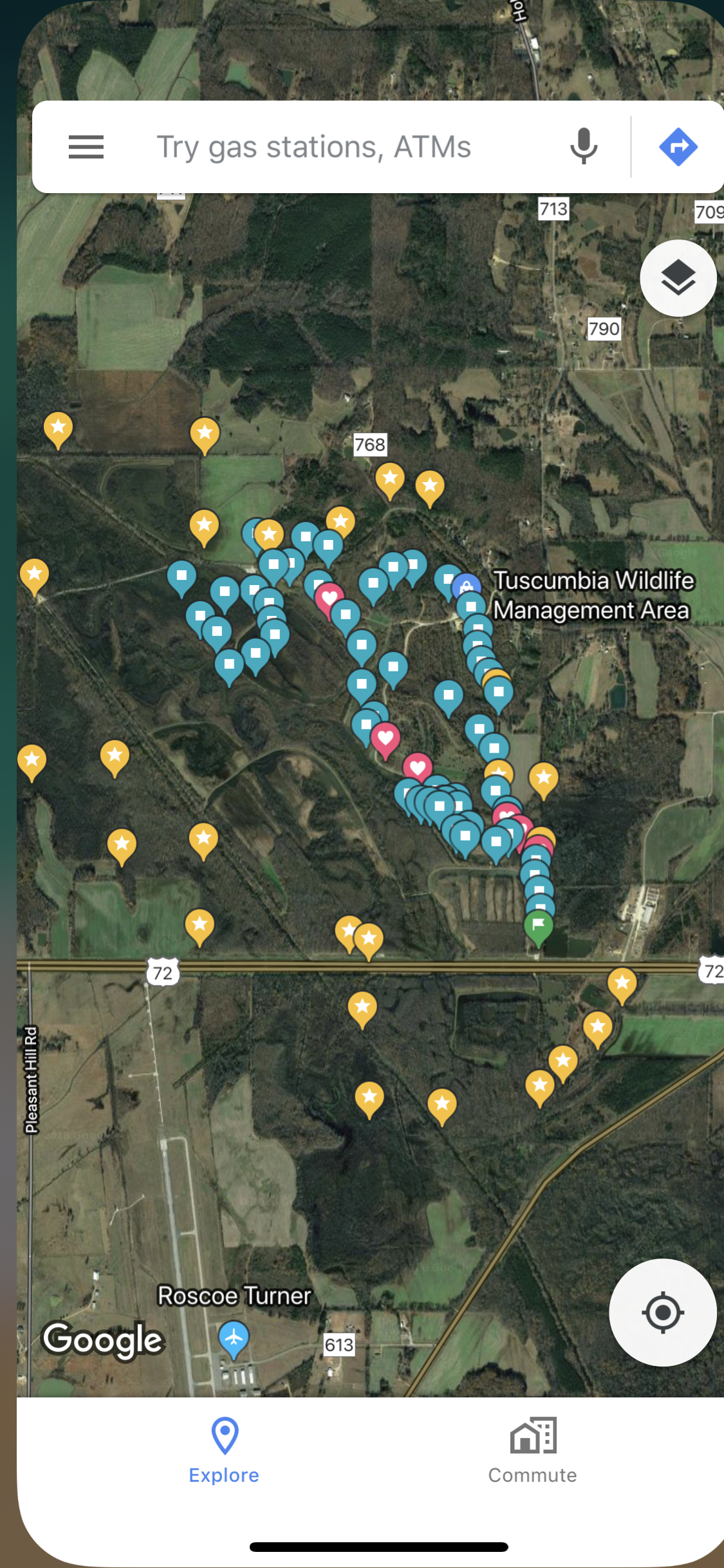
WMA boundary is indicated by yellow stars (created by dropping pins and adding to starred places in google maps app), my walk is indicated by squares (also created by dropping pins in google maps app).
I am reminded that public land hunting often equates to public land walking, and that’s okay. One of the reasons I enjoy upland hunting so much is the physicality involves: long hikes over rough terrain carrying gear and guns.
